Ukraine Control Map@UAControlMap·46dWorld
@Exilenova_plus Further update from Robert Brovdi, 1st Unmanned Center did the strike. https://t.co/7fxce72nIK
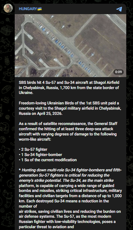
@Exilenova_plus Further update from Robert Brovdi, 1st Unmanned Center did the strike. https://t.co/7fxce72nIK
And thanks to @neonhandrail who recorded strikes in that direction
Ukrainian drones struck the Shagol airfield, claiming to destroy a Su-34 and 2 x Su-57 on the 25th April 2026 Thanks to @Exilenova_plus for being a champ with the satellite imagery. Only looks like one aircraft struck to us though
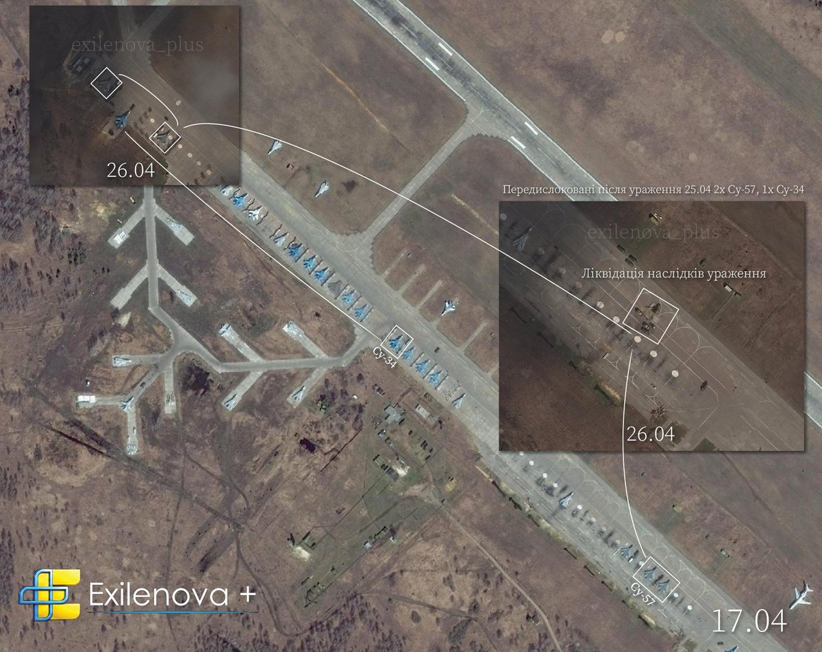
@Exilenova_plus We should say claimed destruction, as there's nothing at those aircraft on the imagery in the satellite to say they've been struck
@Exilenova_plus And thanks to @neonhandrail who also recorded some geo locations on the day towards the metallurgical plant. Seems the drones spotted some juicier targets on the way!
19/19 Ukrainian middlestrike destroyed a Bukhanka near Melitopol ~70km deep Coordinates: 47.080820, 35.360010 Source:
18/ 39th Anti aircraft missile Regiment Posipaki intercepts Zala near Ruso Barvinivka, Zaporizhia Coordinates: 47.819606, 35.935891 Source:
Daily Ukraine map thread for Thursday 30 April 2026 Highlights: A focus on the west of Zaporizhia area today, where the initial Russian infiltrations have been reversed and they're back to no difference than at the start of the year, except for the ones who are dead. Towards


Thanks to GE Pro sat imagery from 4 September 2024 we can see that over a year after the attack, two out of the three damaged Il-76s were still at the base and had not been repaired.


Update on the Pskov drone attack targeting Il-76s, over two years later - as is often the case with Russian aircraft, those reported as "damaged" have yet to return to service and are likely permanent losses.
Russian casualties per grouping from the leak today, Jan 1st - Sept 1st 2025

Rough point of view - 44.709437, 37.786049 Novorossiysk, Russia @GeoConfirmed @AndrewPerpetua

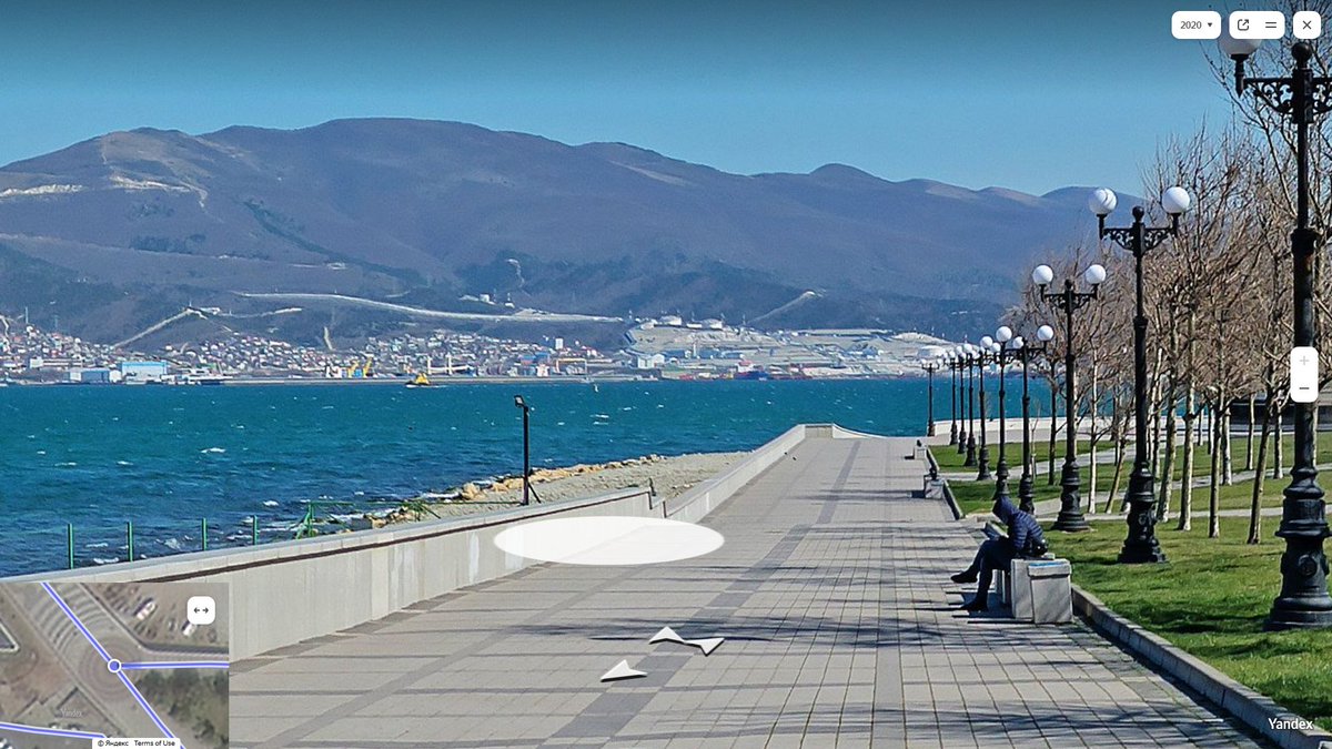
The Black Sea Fleet briefly became the Brown Trou Fleet momentarily when a Ukrainian USV entered Novorossiysk bay before being destroyed. It is a VERY target rich environment there

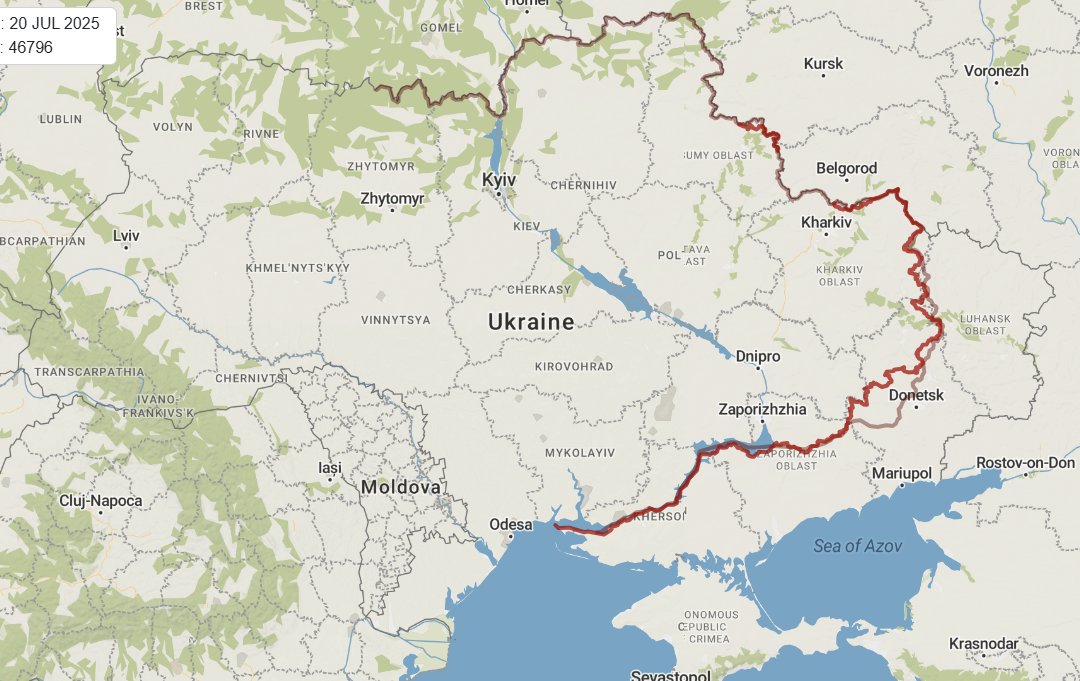
Perspective. This is the map from the end of Ukraine's counteroffensive at the end of 2022, vs now in July 2025. The dark red line is now, the lighter one was then. Look at the macro picture. We often have people in our replies going "You're reporting Ukraine losing village after village, surely they are losing"…
Insane. Footage shows Ukrainian drones at work deep inside Russian territory, obliterating Russian strategic aviation.
FUCKING MASSIVE
@secretsqrl123 Please stop using our map, and stop slapping your arrows and logo, and terrible analysis on it. This is an absolutely idiotic take.
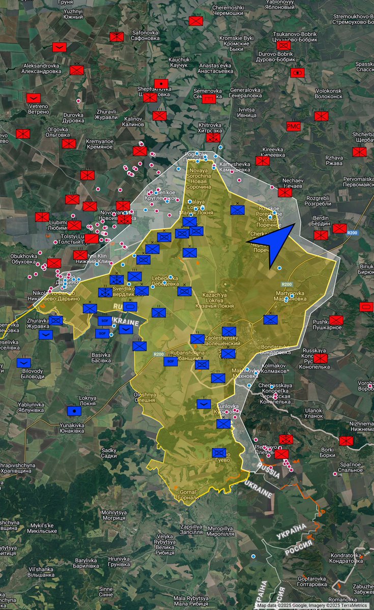
Russian telegram reports Ukraine undertook offensive action in Kursk this morning, pushing north-east towards Berdin and Bol'shoe Soldatskoe
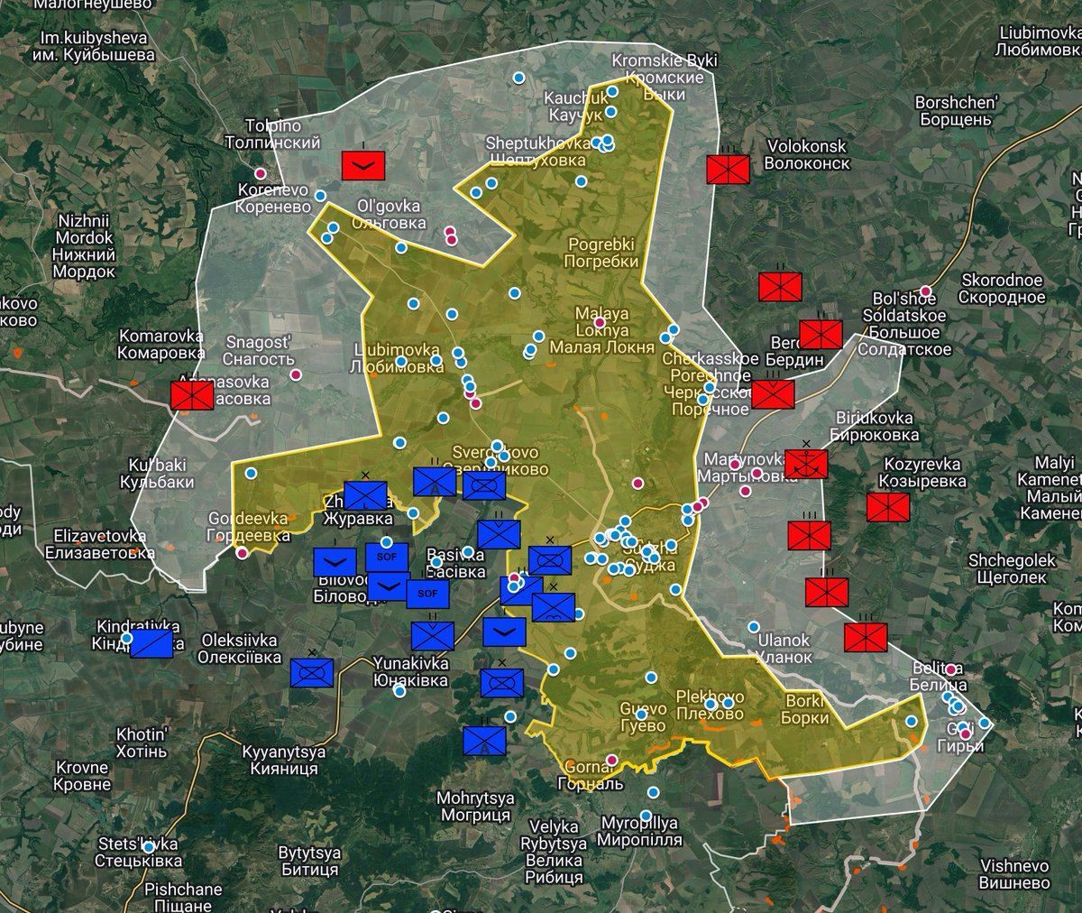
Daily Ukraine map thread for Wednesday 14th August 2024 Highlights: Ukrainian forces advance further in Kursk oblast, raising the flag over Vnezapnoe as well as showing increased presence in captured areas Russia captures Zhelanne near Pokrovsk Map: https://t.co/OFMVnlMoYl
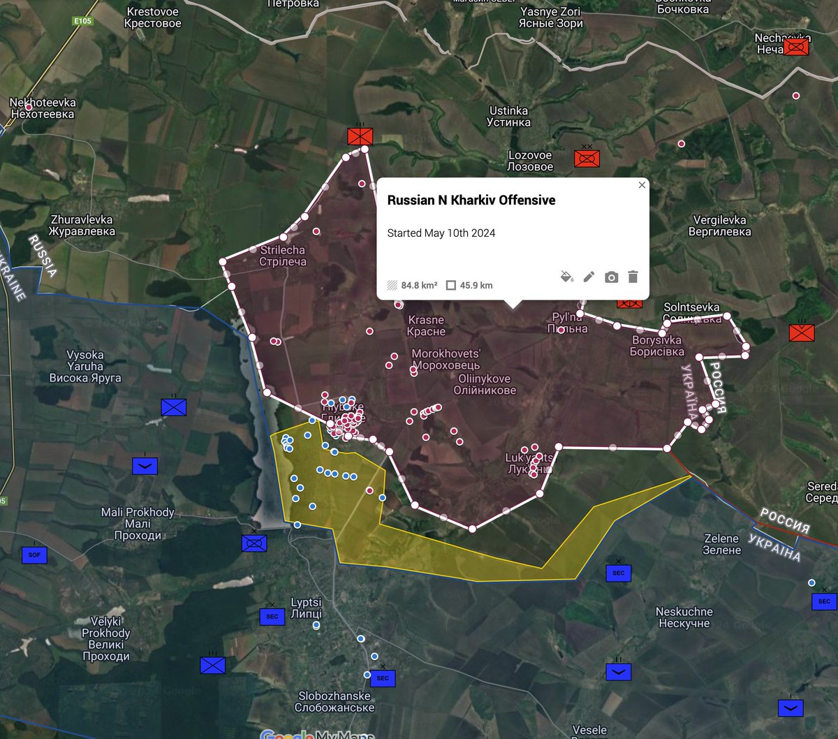
To give a bit perspective to how big the current incursion is into the kursk oblast , currently the area we are talking about is roughly 250km2, based on the known geolocations. The area currently occupied since the "second" Kharkiv offensive is roughly 180km2.


@NOELreports That's nice of them to let Ukraine know that Russia will surrender
The Ukrainian 35th Marine Brigade liberate Storozheve Source: https://t.co/7XH9Fopo3u