S2 Underground@s2_underground·371dWorld
Quoting @s2_underground
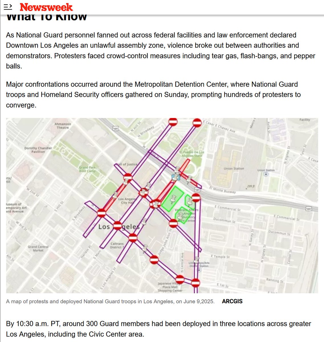
Update on the LA Riots for Sunday afternoon: Situation remains tense, with moderate levels of chaos so far this afternoon. Most of the activity continues to be located around the ICE facility, the courthouse, and conglomeration of federal buildings in the city center. Purple polygons are Key Terrain, specifically roads that have been closed (or at least attempted to be closed). A few hours ago the unrest spread to the 101, which has remained shut down as a police line is in place under the Los Angeles Street overpass. Map updates are continuing as more data trickles out, and I hope to have a better understanding of the general crime that's been rampant throughout the city since these riots started. While everyone is looking a the city center, opportunistic criminals are taking advantage of the fray. The End of Evening Nautical Twilight (EENT) is in about an hour, so after the sun finishes setting we'll see how many rioters remain on site. For those who are just seeing these mapping products for the first time, all of the links you need are attached to this post below:
Hey @Newsweek why did you feel the need to steal my work without giving me any credit whatsoever? You never even contacted me for permission to use my work, which is copyrighted and NOT permitted for commercial use. You literally committed copyright infringement in the clearest possible way, and used my map products…